Mt. Parnitha Welcomes First Snowfall as Chilly Temperatures Blanket Greece
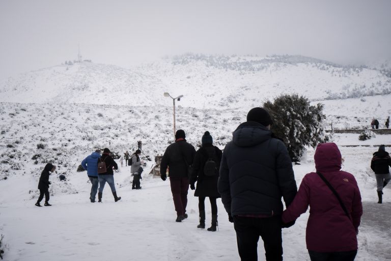
Πηγή Φωτογραφίας: Η Πάρνηθα στα λευκά, (02/01/19) Πέμπτη 3 Ιανουαρίου 2018. (EUROKINISSI/ΑΝΤΩΝΗΣ ΝΙΚΟΛΟΠΟΥΛΟΣ)
The first snow of 2024 started falling on the Mt. Parnitha over 900 meters on Tuesday afternoon, forcing authorities to shut down to traffic the avenue of the same name in north-western Athens.
Police announced the closure of the avenue citing snowfall and ice conditions.
Snowplows have been deployed out on the streets in the broader area to avoid motorists being trapped in the snow or ice.
Meteorologists have forecast a snow spell on Tuesday and Wednesday and a second one over the upcoming weekend.
According to weather forecast, it is possible to see snow in Attica and at lower altitudes in northern and eastern areas of the region during Saturday and Sunday, January 13-14, 2024, while temporary snowfall may occur also in the center of capital Athens.
The cold weather front accompanied by temperature drop and snow is to hit Greece on Friday and last until Sunday.
Local rain- and snowfall will continue in the next few hours of Tuesday in the continental highlands, in Thrace and temporarily in the islands of the northeastern Aegean (mainly Lemnos – Samothraki) as well as in the semi-mountainous areas of the northern and central country.
Weather Forecast Jan 9-13
According to state broadcaster ERT, rainfalls and local storms were forecast for Tuesday (Jan 9) mainly in the eastern and southern parts, with the phenomena being intense in the Cyclades islands, Crete, the islands of the Eastern Aegean, the Dodecanese and the Southern Peloponnese.
Snowfall will occur in the mountainous and semi-mountainous parts of Macedonia, Thessaly and possibly Evia, as well as in areas of Thrace and the islands of the Northeast Aegean with low altitude.
✅Θα συνεχιστούν τις επόμενες ώρες οι τοπικές βροχές και οι χιονοπτώσεις στα ηπειρωτικά ορεινά, στη Θράκη και πρόσκαιρα στα νησιά του βορειοανατολικού Αιγαίου (κυρίως Λήμνο – Σαμοθράκη) καθώς και στις ημιορεινές περιοχές της βόρειας και κεντρικής χώρας. Τη νύχτα τα φαινόμενα… pic.twitter.com/kiKecHKPrS
— Theodoros Kolydas (@KolydasT) January 9, 2024
According to the categorization of the rainfall episode (Regional Precipitation Index), which is applied by the Meteo unit of the National Observatory of Athens, the rainfall episode for tomorrow, Wednesday (Jan 10) when the most intense phenomena are expected, is classified as Category 3 (Significant).
Saturday (Jan 13) will be the coldest day, as new even colder air masses will come to Greece.
In addition, there will be local hailstorms in the Cyclades, Crete, the Dodecanese and possibly the southern Peloponnese.
There will be a significant strengthening of the winds in the Aegean Sea, where they will blow from northerly directions with almost gale-force 7 Beaufort and locally in the North Aegean with 8 Beaufort.
The significant drop in temperature will be particularly felt initially in the north and then in the rest of the eastern parts of the country.
No weather warning has been issued – and probably will not – as snow in January is quite normal, despite the climate change.

Διαβάστε όλες τις τελευταίες Ειδήσεις από την Ελλάδα και τον Κόσμο